[Compiled from data from the Geographical Survey Institute and "Active Faults in Japan (Revised Edition)"]
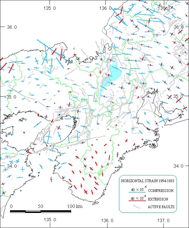
The area is compressed in a roughly east to west direction, except for the Kii Peninsula. This peninsula extends in a northwest-southeast direction due to the effects of the 1944 Tonankai Earthquake and the 1946 Nankai Earthquake. The high values for the Tango Peninsula (Tango Hanto) are a result of the 1927 North Tango Earthquake (Kita-Tango Earthquake).
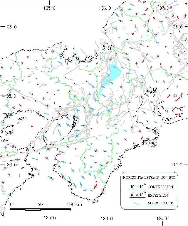
There has been compression in a northwest-southeast direction on the Kii Peninsula. The effects of the 1995 Southern Hyogo Prefecture Earthquake are not included since the earthquake occurred outside the time of measurement.