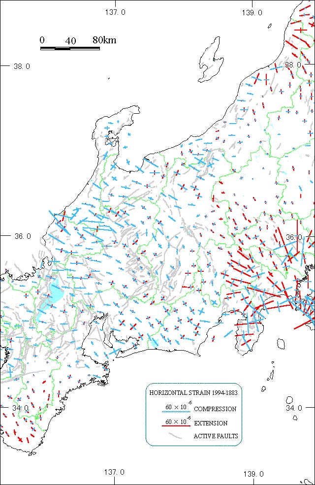
[Compiled from data from Geographical Survey Institute and "Active Faults in Japan (Revised Edition)"]
In the west side of the Itoigawa-Shizuoka tectonic line, overall compression is seen from a northwest-southeast direction to an east-west direction. The high values near the Fukui Plain (Hukui Heiya) are a result of the 1948 Fukui Earthquake.
In the northern Izu Peninsula, earthquake swarms and submarine volcanic eruptions reflect the marked extension.