Figure4-5 Extension and compression in the Tohoku region.

The directions of the two straight lines that cross each other in the figures are those of the maximum extension (or minimum compression; red) and the maximum compression (or minimum extension; blue), respectively. Also, the lengths of the straight lines are in proportion to the amount of the extension or compression.

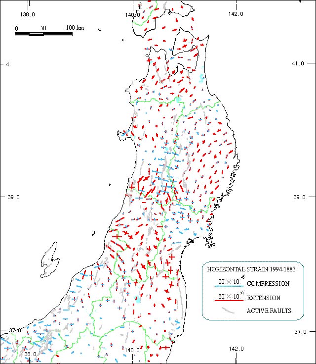
[Compiled from data from "Active Faults in Japan (Revised Edition)" and Geographical Survey Institute]

A: The past approximate 100 years.


Extension in a north-south direction can be seen in most areas. This is not simple compression from east to west caused by the subducting Pacific Plate.

B: The past approximate 10 years.


Extension in an east-west direction with the 1983 Central Sea of Japan Earthquake can be seen along the northwestern coast of Akita Prefecture and the western coast of Aomori Prefecture.