[Compiled from data from "Active Faults in Japan, Revised Edition" and Geographical Survey Institute]
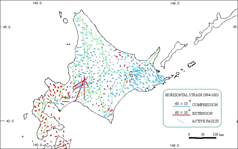
Compression in eastern Hokkaido from the southeast to northwest has been pronounced due to the subducting Pacific Plate, while extension is evident on the Oshima Peninsula(Osima Hanto). The high value for the area near Yubari-si (Yubari City) is thought to be due to coal mining and other factors.
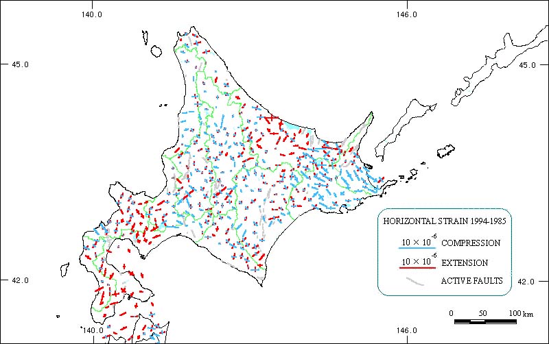
Compression in eastern Hokkaido from southeast to northwest is apparent due to the subducting Pacific Plate.